


Property owners have 90 days from Thursday, Aug. 21, to appeal aspects of the new Flood Insurance Rate Map developed by the Kansas Department of Agriculture.
Labette County started its appeals period on Thursday — and it ends Nov. 19. Neosho County started its appeals period on July 18, ending Oct. 16. Cherokee County started its appeals period on July 10, ending Oct. 8. Allen County started its appeals period on July 3, ending Oct. 1.
If the process goes smoothly, the maps will go into effect in the summer or fall of 2026, according to Joanna Rohlf, floodplain mapping coordinator for the KDA.
Proposed Flood Insurance Rate Maps were released for public view in 2023. Before the new map is finalized, property owners and lessees will have one more opportunity to provide engineering data through their community during the 90-day appeal process. The new map will provide communities with up-to-date flood risk information and tools that can be used to enhance local mitigation plans and help local officials and residents make informed decisions about reducing flood risks and purchasing flood insurance, according to a KDA release on the subject.
The local mapping project is part of a nationwide effort led by the Federal Emergency Management Agency to increase local knowledge of flood risks and to support actions to address and reduce those risks.
Submitting an appeal requires developing science- based data or technically backed information to replace or update preliminary engineering, which can require a significant investment of time and money. Those interested in submitting an appeal are recommended to first discuss it with their local floodplain administrator to help provide guidance on the process, as appeals must be submitted through your local floodplain administrator. Charlie Morse is the floodplain administrator in Labette County.
He’s also the emergency management director and the sanitation officer for the county.
Holly Mathews is the Geographic Information Systems Coordinator and the Floodplain Manager for Neosho County.
Appeal period guidance along with contact information for other floodplain administrators is available at the KDA– DWR website under the Lower Neosho Custom Watershed mapping project page.
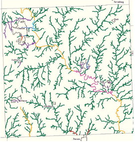
Map courtesy of Kansas Department of Agriculture
The new map, which can be found on the KDA–DWR website, is still a preliminary version.
For contact information, to view the new maps, or to find out more about Kansas floodplain mapping projects, visit www. agriculture.ks.gov/floodplainmapping; select “Lower Neosho Custom” to view the mapping project.